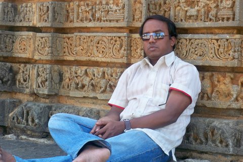
Handsome boy from Bengaluru

Articles from Shiva Shankar R. Shetty

Monday, May 27, 2013

Green Route Trek!


Sakleshpura Trekking

The railway segment joining Sakleshpur and the Kukke Subramanya road junction is known as the ‘Green Route’. Located in the Western Ghats, Sakleshpur is a town with bountiful greenery. This route is located along the Hassan and Canara regions of the state of Karnataka.
One can start trek either from Sakleshpur or Subramanya Road Station. The length of the trek is 53 km and your trail will comprise of 59 tunnels which are an absolute terrestrial abyss, 110 bridges and over 25 stunning waterfalls. The Green Route trek offers absolute wilderness to nature lovers and the lengths of the tunnels vary from few meters to over 600 meters.
The main trek begins from Donigal, a small railway station that lies 8 km after Sakleshpur along the Shiradi Ghats. The trek is also famous for its frequent encounter with wild elephants in the Gundya and Sakleshpur range.


Thursday, May 16, 2013

ಮದುವೆಯ ಹಾರ್ದಿಕ ಶುಭಾಶಯಗಳು


ನಿನ್ನೆಯಷ್ಟೇ ಮದುವೆಯಾಗಿ ಹೊಸ ಜೀವನದ ಹೊಸ್ತಿಲಲ್ಲಿ ಹೆಜ್ಜೆಯನ್ನಿಟ್ಟ, ಆಪ್ತ ಮಿತ್ರ ತಿಮ್ಮರಾಯ ಗೌಡನಿಗೆ ನನ್ನ ಹಾರ್ದಿಕ ಶುಭಾಶಯಗಳು. ಮದುವೆಯ ರೇಸ್‍ನಲ್ಲಿ ನನಗಿಂತ ಮೊದಲು ಖೆಡ್ಡಾಗೆ ಬಿದ್ದ, ಅವನ ವೈವಾಹಿಕ ಜೀವನ ಸುಮಧುರವಾಗಿರಲೆಂದು ಹಾರೈಸುತ್ತಾ..


ಶುಭಾಶಯಾ .................ಶುಭಾಶಯಾ.................
ಮದುಮಗನಿಗೂ......ಮದುಮಗಳಿಗೂ .......ಶುಭಾಶಯಾ.....
ಹೊಸ ಹರೆಯದ ,ಹೊಸ ಜೋಡಿಗೆ ಶುಭಾಶಯ.......

ಮದುವೆಯ ಈ ಬಂಧಾ ಅನುರಾಗದ ಅನುಬಂಧ
ಏಳೇಳು ಜನುಮದಲೂ ತೀರದ ಸಂಬಂಧ 
ಮದುವೆಯ ಈ ಬಂಧಾ ಅನುರಾಗದ ಅನುಬಂಧ
ಏಳೇಳು ಜನುಮದಲೂ ತೀರದ ಸಂಬಂಧ


ಸವಿಯಾದ ಮಾತು , ಸಿಹಿಯಾದ ಊಟ ,ಸೊಗಸಾದ ನೋಟವಿರಲಿ
ಮನೆ ತುಂಬುವಂತ,ನಗೆ ಚೆಲ್ಲುವಂತ ,ಮುದ್ದಾದ ಮಗುವು ಬರಲಿ

ಮದುವೆಯ ಈ ಬಂಧಾ ಅನುರಾಗದ ಅನುಬಂಧ
ಏಳೇಳು ಜನುಮದಲೂ ತೀರದ ಸಂಬಂಧಾ

ಮನಸನ್ನು ಅರಿತು, ಒಂದಾಗಿ ಬೆರೆತು ನಡೆದಾಗ ಬಾಳು ಕವಿತೆ
ನೂರೊಂದು  ವರುಷ ,ಚೆಲ್ಲಿರಲಿ ಹರುಷ ,ಬೆಳಗಿರಲಿ ಒಲವ ಹಣತೆ

ಮದುವೆಯ ಈ ಬಂಧಾ ಅನುರಾಗದ ಅನುಬಂಧ
ಏಳೇಳು ಜನುಮದಲೂ ತೀರದ ಸಂಬಂಧಾ 

ಸಿರಿತನದ ಸಿಹಿಯು ,ಬಡತನದ ಕಹಿಯು ,ನಿಮಗೆಂದು ಒಂದೇ ಇರಲಿ
ಸಮನಾದ ಪ್ರೀತಿ, ತೋರುವುದೇ ರೀತಿ,ಬಿರುಗಾಳಿ ಏನೇ ಬರಲಿ

ಮದುವೆಯ ಈ ಬಂಧಾ ಅನುರಾಗದ ಅನುಬಂಧ
ಏಳೇಳು ಜನುಮದಲೂ  ತೀರದ
ಮದುವೆಯ ಈ ಬಂಧಾ ಅನುರಾಗದ ಅನುಬಂಧ
ಏಳೇಳು ಜನುಮದಲೂ ತೀರದ ಸಂಬಂಧ.


CA SHIVA SHANKARA R. SHETTY
CHARTERED ACCOUNTANT
Mobile: +91 9035846043 Email: ca.srshetty@icai.org
www.casrshetty228359.in

Friday, May 3, 2013

Hogenakkal Falls

Hogenakkal Falls


Hogenakkal Falls or Hogenakal Falls is a waterfall in South India on the river Kaveri. It is located in the Dharmapuri district of the southern Indian state of Tamil Nadu, about 180 km (110 mi) from Bangalore and 46 km (29 mi) from Dharmapuri town. It is sometimes referred to as the "Niagara of India". With its fame for medicinal baths and hide boat rides, it is a major site of tourist attraction. Carbonatite rocks in this site are considered to be the oldest of its kind in South Asia and one of the oldest in the world. 

The word Hogenakal is formed of two Kannada words hoge and kal. When the water falls on the rocks it appears as if hoge (smoke) is emanating from the top of the kal (rock) because of the force of the water, hence Hogenakkal (smoking rocks). It is also called as Marikottayam by the people of Tamil Nadu.

Kaveri River
The Kaveri is considered to form at Talakaveri in the Brahmagiri hills in the Western Ghats of south India and gathers momentum as the land drops in elevation. It becomes larger as various tributaries feed into it on the way down. At Hogenakkal, the Kaveri, now a large river, drops and creates numerous waterfalls as the water cuts through the rocky terrain. In places the water falls as much as 20 m (66 ft) and is said to sound like continual thunder. Soon after the falls the river takes a southerly course and enters the Mettur Stanley Reservoir. The river carries sediment which makes the downriver land fertile.

At Hogenakkal the river spreads out over a wide area of sandy beaches, then flows through to the Mettur Dam and creates a 60 sq mi (160 km2). lake called Stanley Reservoir. Built in 1934, this project improved irrigation and provided hydropower.

Boating in Hogenakkal
Boating in Hogenakkal is allowed during the dry-season as the water falls are not strong enough to disrupt the passage of the boats. This is the main source of income for these boat operators. The coracles are about 2.24 m (7 ft 4 in) in diameter, but still can take a load of eight persons at a time. These coracles are made of bamboo, and with all materials available takes about a day to build. The bottom of the boats are made waterproof by the use of hides, but sometimes with sheets of plastic. Use of plastics in the Hogenakkal vicinity, not just for boats, has been criticised due to problems with pollution. These boats are steered and propelled using a single paddle, making them unique. The coracles are locally called parisal in Tamil and either teppa or harigolu in Kannada.

Freshly caught fish are sold by the gorge and also various vendors selling water and snacks up and down the gorge rowing their coracles is not uncommon. The fish caught include katla, robu, kendai, keluthi, valai, mirgal, aranjan and jilaby. After leaving the gorge, on the left shore one can find improvised stalls set up on the sand. There, one can let the fresh fishes be prepared in one of the many kitchens. Also, many people can be found swimming or bathing around there.


The text taken from www.http://en.wikipedia.org


CA SHIVA SHANKARA R. SHETTY
CHARTERED ACCOUNTANT
Mobile: +91 9035846043 Email: ca.srshetty@icai.org
www.casrshetty228359.in
Thursday, May 2, 2013

SUNSET IN AGUMBE


SUNSET IN AGUMBE

         Agumbe (Kannada: ಆಗುಂಬೆ) is a village located in the Shimoga district in the state of Karnataka, India. Located in Thirthahalli taluk and the Malnad region, Agumbe is among the places in India that receive very heavy rainfall earning it the sobriquet, "Cherrapunji of the South". Agumbe Rainforest Research Station, the only permanent rainforest research station in India is established here. The renowned herpetologist, Romulus Whitaker called Agumbe the capital of King Cobra. An area near Agumbe has been converted into a protected area for Medicinal Plants to help conservation.


 Sunset Point

Sunset in Agumbe is beautiful. There is a sunset point, located on the 14th hair pin bend on the serpantine road to Agumbe (from Udupi) which receives a lot of visitors. On a clear day, one can see the sun setting over the Arabian Sea though the sea is quite a long distance from Agumbe.

These video clips taken in AVCHD (HD) format.


CA SHIVA SHANKARA R. SHETTY
CHARTERED ACCOUNTANT
Mobile: +91 9035846043 Email: ca.srshetty@icai.org
www.casrshetty228359.in

Jog Falls (ಗೇರುಸೊಪ್ಪೆ ಜೋಗ)


Jog Falls (ಗೇರುಸೊಪ್ಪೆ ಜೋಗ) is the second-highest plunge waterfall in India, Located near Sagara, Karnataka, these segmented falls are a major tourist attraction. They are also called Gersoppa Falls, Gersoppa Falls and Jogada Gundi.

Jog Falls is created by the Sharavathi River falling from a height of 253 m (830 ft), making it the second-highest plunge waterfall in Asia after the Nohkalikai Falls with a height of 335 m (1100 ft) in Meghalaya.


Sharavati, a river which rises at Ambutirtha, next to Nonabur, in the Thirthahalli taluk and takes the northwesterly course by Fatte petta, receives the Haridravati on the right below Pattaguppe and the Yenne Hole on the left above Barangi. On arriving at the frontier it bends to the west, precipitates itself down the Falls of Gersoppa, and passes that village (properly Geru-Sappe), which is some 29 kilometres distant, discharging into the sea at Honnavar in North Kanara.


The Sharavati, flowing over a very rocky bed about 250 yards wide, here reaches a tremendous chasm, 290 m (960 ft) deep, and the water comes down in four distinct falls. The Raja Fall pours in one unbroken column sheer to the depth of 830 ft (250 m). Halfway down it is encountered by the Roarer, another fall, which precipitates itself into a vast cup and then rushes violently downwards at an angle of forty-five degrees to meet the Raja. A third fall, the Rocket, shoots downwards in a series of jets; while the fourth, the Rani, moves quietly over the mountain side in a sheet of foam. The Tourism Department has built steps from the viewpoint to the bottom of the hill where the waterfall can be seen at the opposite side. There are approximately 1400 steps built to reach the bottom of the hill.

Joga is a Kannada word meaning falls. Many Kannada speakers near Sahyadri Mountains such as in Yellapura region still use the this word Joga to mean falls. The word Joaga may have derived from Javuga which is form of the word Javalu which means water coming out forming wetlands. Jog Falls therefore could be a misnomer meaning falls falls.

Associated with the waterfall is the nearby Linganmakki Dam across river Sharavathi. The power station has been operational since 1948 and is of 120 MW capacity, one of the largest hydroelectric stations in India at that time and a small source of electric power for Karnataka now. The power station was previously named Krishna Rajendra hydro-electric project, after the King of Mysore at that time. The name was later changed to Mahatma Gandhi Hydro-electric Project. It was served by Hirebhaskara dam until 1960. After 1960, due to the ideas of Sir M. Visvesvarayya, Linganmakki Dam has been used for power generation. For more information check the Jogfalls official website: www.jogfalls.in.

Before the onset of monsoon season, when there is not much water in the Linganmakki dam, the Jog Falls are a pair of thin streams of water trickling down the cliff, as the water collected in the dam is exclusively for generation of electricity; during monsoons local rain water is the source of water to the falls.


The text taken from www.en.wikipedia.com


CA SHIVA SHANKARA R. SHETTY
CHARTERED ACCOUNTANT
Mobile: +91 9035846043 Email: ca.srshetty@icai.org
www.casrshetty228359.in

Kundadri: The Sunrise Point near Agumbe


Kundadri: The Sunrise Point near Agumbe


Kundadri is about 13-14 kilometres away from Agumbe in the direction of Teerthahalli and Shimoga. It is situated at a height of about 900 meters above the sea level.This place also houses the temple of Humcha Jain Mutt whose main attraction is a pond which is percieved to never dry.

For better view of sunrise, one must leave the Agumbe 5.00 AM itself and there is no public transport available from the Agumbe. There are only two auto riksha's available for taking the visitors from Agumbe to Kundadri. But, we should be call them and confirm before night only.

If, visitors came by own vehicle, then no problem. But, visitors should leave the Agumbe at 5.00 am itself to reach Agumbe. Otherwise, one can miss the beauty of sunrise.

We left our guesthouse at 5.15 am and we reached the Kundadri at 6.15 am. When we reached the Kundadri, there is no other humans being. After 6.30 am sun started to rise. But, people came around 7.00 am after the sunrise and they missed the beauty of sunrise.

The vehicle goes through the forest and we seen rabbit which crossing the road in the dark. We don't recognised any other animals which may be standing in road side. Because, every tree looks like "someone standing there".

One can shout that, "For see the rabbit, we should go Agumbe?" Yes, I will agree. We can see the rabbit in the Shivaji Nagar. But, that is not a natural place of rabbit. In shivaji Nagar, it never shows its natural activity. But, in Agumbe forest we saw its natural activity.


The above video clips are taken in AVCHD (HD) format.


CA SHIVA SHANKARA R. SHETTY
CHARTERED ACCOUNTANT
Mobile: +91 9035846043 Email: ca.srshetty@icai.org
www.casrshetty228359.in